
ISR PLATFORM
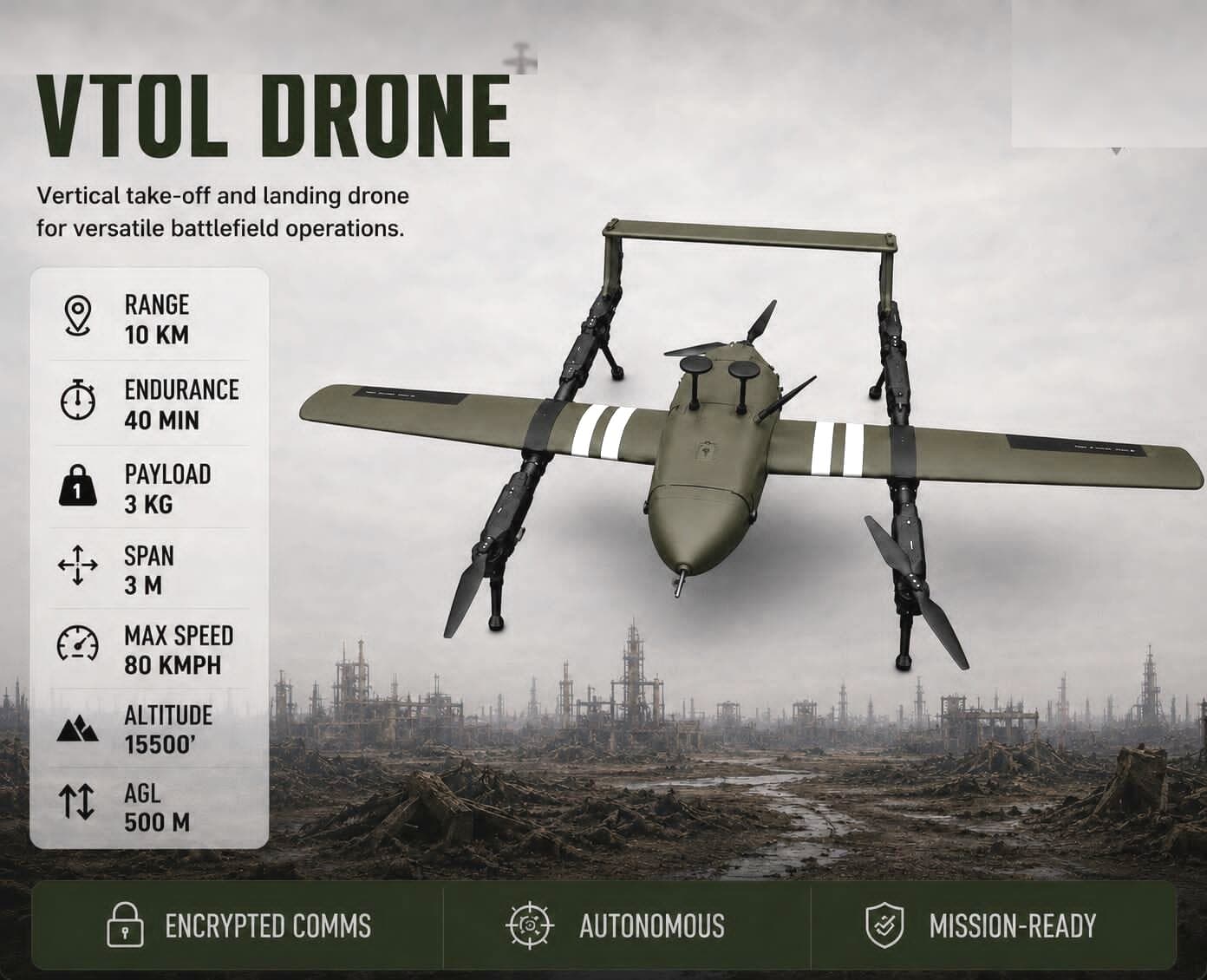
VTOL Drone
A mission-configurable VTOL platform for persistent surveillance, reconnaissance, and rapid situational awareness.
- Encrypted Comms
- Autonomous
- Mission-Ready
ISR PLATFORM
Quadplane VTOL
01 / 01
Schematic view
Mission profiles
Where the VTOL Drone fits.
- Surveillance
- Delivery
- Mapping & Surveying
- Inspection
- Search & Rescue
- Military & Defense
Defence & Homeland Security
Persistent ISR, perimeter awareness, route reconnaissance, and rapid-response aerial capability.
Critical Infrastructure
Repeatable inspection of bridges, towers, pipelines, rail corridors, and hard-to-reach assets.
Energy & Mining
Safer aerial inspection, stockpile measurement, thermal surveys, and wide-area site intelligence.
Emergency Response
Fast situational awareness for search, rescue, disaster assessment, and incident command.
Surveying & Mapping
High-resolution geospatial data for land surveys, construction progress, and digital-twin workflows.
Reference sheet
Platform data sheet
- agl
- 500 M
- span
- 3 M
- range
- 10 KM
- payload
- 3 KG
- altitude
- 15,500 FT
- max Speed
- 80 KMPH
- endurance
- 40 MIN